Sequoia National Park

Mid July this summer we at last visited the Giant Trees. Sequoia Park and Kings Canyon are both connected, they are on the same entrance ticket, but you can’t see both of them in one day. So we had to land from the heights of the Sequoia Park at the end of the first day and go back up the next day to see Kings Canyon. The point is that it is hard to find a place to sleep in between them . As I noticed visitors mostly camp there. There are several lodges inside the parks, but to pay $350 for a night is not in our practice. And when you land from the Sierras there – there are maybe 2-3 motels on the way, not good at all, therefore they have vacancies. And then nothing, a long stretch of driving with orchards, with towns who serve the orchards – and no motels hotels, very strange…the closest city came out to be Fresno, though with the help of people from supermarket we managed to find a Best Western somewhere in between those orchard – little town jungles. So this is my introduction to the Giant Tree impressions…Some facts impress more than others…:-)

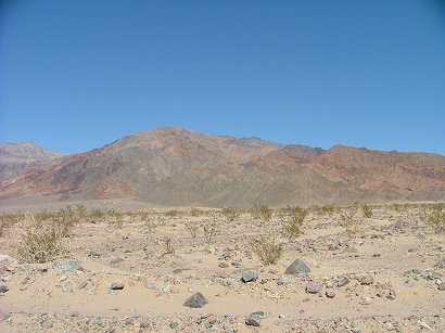
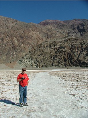
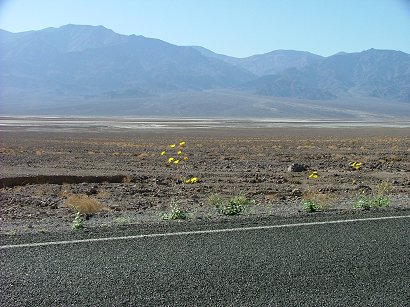
But here is everything from the beginning. We drove through Las Vegas, then towards Bakersfield. California’s attention to renewable energy sources impresses:

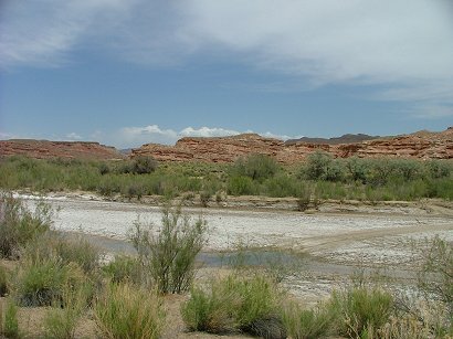
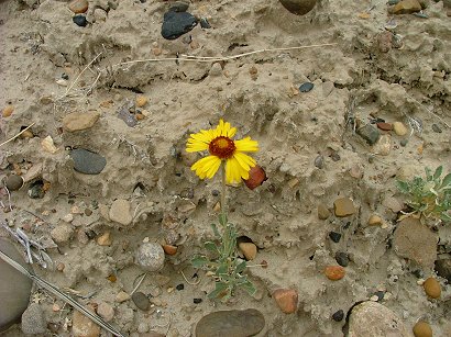
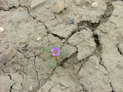
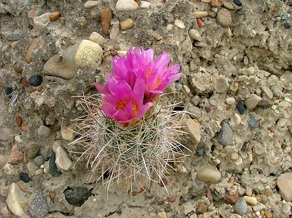
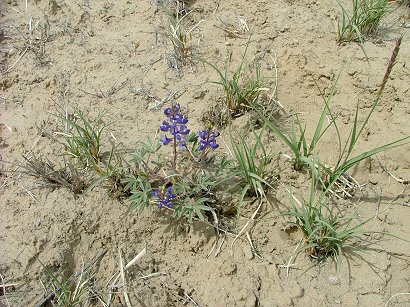
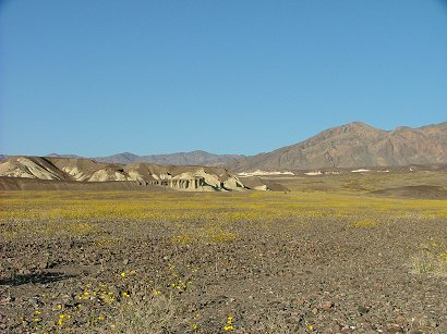
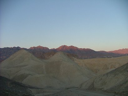
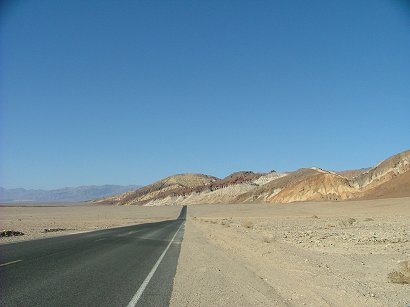
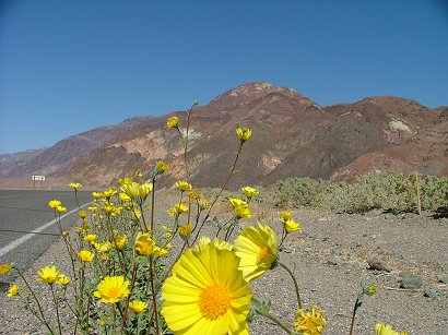
After a night in Bakersfield we headed towards Sierra Nevada foothills from the West side and started rising towards Sequoias on Rt.198 :

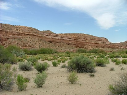
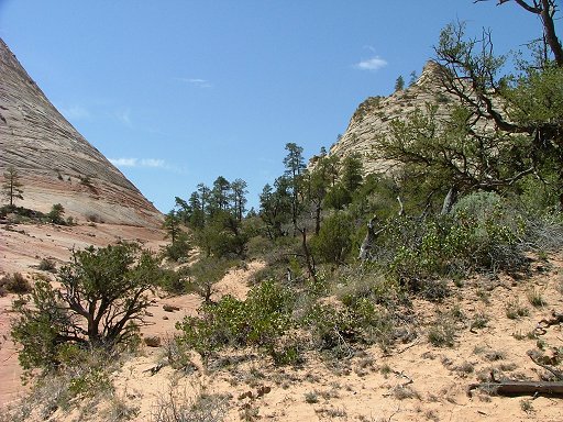
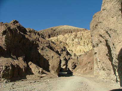
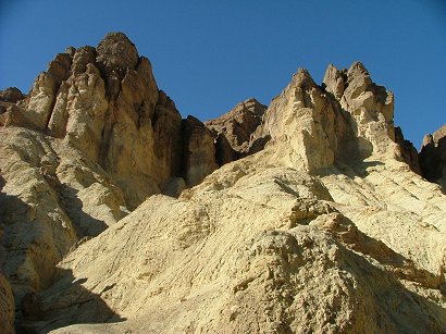
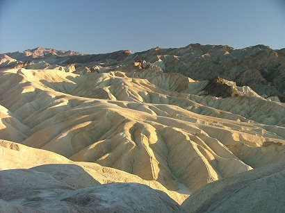
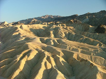
The mountains are in haze and they say that partially it is because of the smog that is brought by winds from San JoaquinValley and partially from the humidity in the air in summer. they sau to see clear views you have to come in early spring. The road up the mountains is narrow and winding which you can expect. The views are beautiful Part of the road was being fixed, so we had to wait and meanwhile we thought that we already reached the Giant Tree grove:

But we haven’t. Those trees were something else, not sequoias yet. Sequoias grow very high – between 5000-7000 feet elevation, which is 1500-2100m in human language. They don’t grow grow on sea level as their cousins Redwoods, as well as they have other differences with redwoods, which i didn’t know before going to the park. Redwoods are a little taller, their trunks are not so massive and they die by 1200 years younger. Whereas sequoias are much more massive, they reach 100 m in height (311 ft) and 14m in diameter (40 ft) and they live up to 3200 years old! That is something…

They outlive many forest fires because of the structure of their bark – it is thick and feels like tissue paper, soft and airy, and though fires sometimes burn holes in them – the heat still doesn’t get the deeper layers. Their wood and bark have some chemicals that make them resistant to fungi and bacteria. Luckily.

And when you think – there are some 75 groves left in all… and all of them are on the West slope of Sierras, where the moisture comes from far away ocean to humidify its branches and the streams of the mountains feed them with water of which they need a lot.

From the Giant Forest Museum we took a shuttle to Moro Rock. Again there was a confusion. The next stop was Crescent Meadow and we planned to see the views from there and return to Moro Rock and climb it/ No way. the shuttle takes you to the Rock, then to meadows and back to the museum…So we did two rounds until we managed to climb the Rock, but on the way we saw this creature:

I felt good we were in the bus not on our feet – because mama bear could be close by.

Moro Rock was impressive, reminded me of Angel’s Landing in Zion NP, only more comfortable steps for climbing it. So the same as on Angel’s Landing I was scared to death to reach the top :-):

Thanks God Andrei reached the top and could enjoy the views of Sierra Nevada mountains:

Next stop was at Big Trees trail – sequoias grow usually around a little pond formed in a hollow of a big stone by some streams. they need water. Those ponds usually are not ponds any more, but a swamp or wet meadow. And therefore sequoia groves look like a circle:

The main cause of sequoias deaths is toppling. They have shallow root system and strong winds can uproot them:

The insides of the fallen trees are attractive:

Some more images of the Giant Trees. the biggest of them is General Sherman tree, but we saw it only from far away – too many people were crowding around it.

So much for this park, it took us a while to find a place to sleep that night as I have mentioned. Next Blog will be about Kings canyon.


How I celebrated April 15th!

I have to make a break in Thailand blogs and describe the events here and now, in Utah. it was almost a historical event – at last we managed to find the right day, the right weather and only light winds and go to Brian Head – to ski. The first and last time in two years. The fact is that either we have to wait for guests when the weather forecast for the ski resort is good, so we can’t go, or the weather is really bad, which happened there most often. I can’t imagine how they make money, so many bad days they even have to close the lifts, the winds there are usually unbearably high. So here we managed at last to get there on April 14th! Almost no cars…they extended their operation for a week because of the amount of snow we all got in this spring. And the student holidays are now over – maybe that was the reason there were almost no people. Rather strange but I should say -comfortable. Like the mountain belongs only to you and all those guys on both ends of the chair lift are here to help only you:

Andrei couldn’t ski, his knee is still not very strong after he twisted it in Thailand, but he took me there and took also his PC so that he would not waste his time, in a cafeteria in this building:

And I also tried not to waste my time, up and down almost non stop. I land from the mountain and just “swish” into the chair again, getting the rest while going up.

To tell the truth it was funny after two years break to get on skis. I felt as if preparing to go into cosmos. Digging out my ski suit, putting on those heavy boots, gloves, cap glasses – here we are almost in summer clothes and over there it is still winter:

One can see how desolate the slopes are – but how nice! The trails are well prepared with that special car, some of them had still their virginity. So comfortable, I never remember such a good skiing there…

The temperature was around 12C and in the sun some parts of snow were a little wet, but didn’t cause problems because there are still frosts at nights over there. And here is the view from the top of the lift – and of that mountain:

You can’t put a price on it!..

And here is the view from Toquerville -the town that we have to pass on our way from Rockville to Rt. 15, toBrian Head:

And yesterday, which was April 15th, we went on a trail from the town Virgin. It took us 8 years of living here to figure out such a nice trail only 10 min drive from home…

We crossed the river on a bridge there and walked along the rather steep and high edge that Virgin river has created during many years:

And there are also inlets with scarce water, some slim waterfalls, but you can’t cross them, too steep, just follow the mountain bike road:

Then we drove to the La Verkin overlook – it has even a sign on highway but we never had a chance to drive those couple of miles and see for ourselves how amazing the view is:

You don’t need to hike up or down – you are here on top of a mountain -where can you find such a comfort?

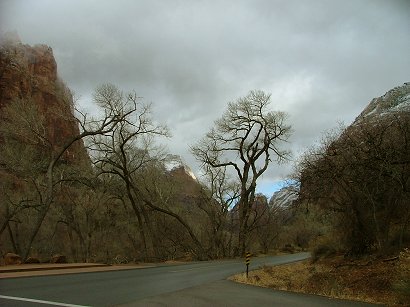
To the right is Toquerville, to the left – Hurricane and St. George.

And here is our pear tree two weeks ago:

and the peach blossoms…

Slot Canyons in Zion’s East

If you enter Zion National Park from the West entrance, after crossing the Virgin river you find yourself doing switchbacks, back and forth until you reach a much higher level and can really enjoy the big picture of Zion mountains. There are some pockets by the road there for you not to slow the other traffic. And then you reach a tunnel which was exploded and created around 1928. Before that people would send mail or logs for houses on a cable connecting the top part of the area to the bottom of the canyon. Therefore one of the mountains here is called Cable mountain. So this tunnel was of great help for locals as well as travelers. Its length is 1.1 mi and it is pretty narrow. It has two lanes for sedan cars, but once those houses on wheels try to get through – they stop the traffic on one side. So sometimes when lots of people who can’t part with their houses travel here, there is a wait period before you can enter the tunnel. It is not so bad if you don’t rush because the views are magnificent. And then the tunnel has three holes-windows in the rock that are supposed to ventilate and give some light. But don’t plan to stop your car and look around through them. Once you get from the tunnel – there is a parking for a really cute trail – Canyon Overlook. I highly recommend it to everyone, it is only 1 mi round trip and is very diverse. But this time we decided to drive further from the tunnel and check the slot canyon on the right from the road. When it rains that canyon becomes a force of nature full of water. But as it is a desert here and it rarely rains, it is mostly a dry exotic path on the bottom of imaginary river with real fantastic walls:

The passage is sometime very narrow and those types of formations are called slot canyons.

At some places the canyon is so dark, gloomy and still have some water in deeper pools, that you have to find your way out to the top top and walk around those unpleasant places:

But then they open up again and there you can see trees growing and turning into fall colors:

It is usually much cooler in those slots than in the area around. Here and there you can notice the signs of the force of water when it rains:

Water and wind have created different forms in slots, arches being one of them.

There is a feeling of being a dust in the vastness of our Mother Nature:

Meanwhile on the high up walls winds are sculpting another arch. I am not sure how many millions of years it takes them to finish their job:

Those little maples are not the regular ones we are used to. And I am sure they are not the sugar maples, ether. They grow in the bottom of the canyon by this imaginary stream and have the form more like bushes, than trees. But nothing can beat their redness in autumn:

Once you get enough of slot canyons you can look for a less vertical slope towards the road and climb you way to there, to your car parked in one of the pockets. The other side of the road has also several interesting trails, which are not designated and are left wild for various wanderers to improvise their walks. It is usually by following the bed of a dry stream, tracking the waterways. One of such walks is called Many Pools trail. We didn’t have time to do it that day, just a little portion of it. It is late autumn and the sun is setting pretty early. Just two images of Many Pools:

For the end – a little pine that grows in a sandstone rock as seen from the road on this same Eastern part of Zion NP:

Kanaraville Canyon in its splendor!

We read about this canyon in our local newspaper three years ago. It is about 50 min drive from us – to Rt 15 and then a little North, one exit after the Kolob Canyons of Zion NP. Once you get off the highway on the Frontage rd. – head North for 4 miles till you see a red nicely painted barn where you turn Right and head towards the canyon. There is a parking there, but nothing else. It is on public lands so no WCs or information is provided. Therefore it is more wild, and you can experience more solitude. The only time we met several groups of people there was the time after the article was published about it. All of them were locals and all of them came because of the article. But the next year we met only a couple of photographers or romantics. This is the most spectacular of all the canyons I have seen, but that doesn’t mean in absolute sense. I still haven’t seen a lot. We visit it each October, closer to the 20th-24th, when the trees are turning into red and yellow hues. Here is the entrance to the canyon:

Though it is not in a National Park, but the path is pretty good, evidently – still popular among locals. It goes by a stream, we don’t even know its name. The stream has an interesting feature – sometimes it looks like a normal stream and sometimes it disappears and leaves a dry bed. It completely disappears very soon after you enter the narrow part of the canyon which makes it easier to walk.

At this time of the year the Rabbit brushes are finishing their yellow blooming. Behind my back there is an entrance to the Narrows. It takes 40 min to walk there:

The pictures are taken in three different trips this year and last year. So some trees are still green and others are already in their full autumn colors. Some are already naked…

Sun or cloudy – those colors were so divine that I can’t resist to share more and more with you:

At some point the canyon becomes very narrow and sun never gets to its bottom, so it is cold there.

Then again it widens and lightens until you get to a place I called “meatgrinder” – an analog from Tarkovskyj’s movie “The Stalker” which at some point was very popular in previous Soviet Union where I grew up and learned to understand the world:

HOw long does it take to go deeper into the canyon – as long as you want. We walked for a hour once the Narrows started and there was no end to be seen. The walk becomes harder, more boulders and trunks to climb in order to proceed, but at the same time it becomes more dramatic. You can feel the force of flash floods that happen when it rains – huge trunks of trees are brought and stuck in the middle of the canyon. Going out is also nice for you see the walls of the canyon in a different angle and it seems it is a different path. You start noticing smaller things:

And once you get into the sun again – it seems so warm and nice…

Out walks usually last around 3-3.5 h. But it is your choice.

When we returned home I took a picture of our Mexican sunflower by the kitchen window together with Chrizantemums:

Zion Narrows

Summers are deadly hot here. Or so I perceive them. The only thing one can do in the park, to my opinion, is hiking the Narrows. Well, there are people who enjoy the heat after spending long and cold winters in the Midwest e.g., so I don’t argue with them. I am happy they can do some other trails in addition to the Narrows. But not me. In the temperatures of human body my body refuses to move… Zion Narrows is the only place you can expect to get some relief from summer’s sweltering heat. Not as much for the reason they are narrow, as the name says, and the sun is not baking the bottom all day long, but because first – you have to walk in the water, and also – there are plenty of places where ancient water that was rained long long ago is soaking through the sandstone walls and creating a natural swamp cooler. But before you get into the Virgin stream you have to suffer a little. You have to get onto the shuttle which is not air conditioned and though the drivers are very interesting in telling their stories about Zion NP, at the end of 45 min ride you start feeling sorry for them – to work all day in this heat…Good they manage not to turn into dried prunes.
Then you get out in the last stop which is called Temple of Sinawawa because there is a natural rock pulpit and an altar in the middle of the square surrounded by tall walls. Good thing there is a toilet there. After that – no water, no toilets, you have to think and organize your life around it. So you start walking from that point towards the depths of the canyon on a paved path – quite a comfortable one. It is 1 mile to the end of the path called Riverside Walk which ends with some stone steps landing to the rocky shore of the river. This is where crowds gather. The ones who prepare themselves for the hike, change their shoes if they have the better ones for river walk, or take off their shoes they are sorry to get wet, and the ones who don’t plan to hike into the river, just watch the hikers or sit on the bigger rocks and have their lunch:

Having that in mind and being already hungry we had our lunch before the very end of the path:
Lunch in Zion
Lunch in Zion

As you may see we were using our ski sticks for support in the water as well as gaining more speed on the even path.

Squirrels are spread out all over that path. They are not afraid of people and some are pretty fat. Which leads to a thought that maybe not all visitors sustain from feeding them which is forbidden…

Here is the beginning of the trail in the water. Yes, very crowded even on a regular weekday. I guess main reasons being school holidays and kids like water. But nevertheless there was enough space for everyone. No accidents, peaceful strolling up and down the river, with some kids swimming in deeper places. We tried to find shallow passages so that our butts don’t get wet, though the water wasn’t cold at all.

This is a very popular place for taking pictures – the stream rolling down the slope is very cute and refreshing. Sometimes you can even see the canyoneering people landing down the stream in zigzags while attached to ropes. This is also the place where the barefooted hikers finish their hike into the canyon.

But on that particular day the crowds proceeded further. And it was beautiful, but not as beautiful as getting far more deeper into the narrows of the canyon as you will see.

As seen in the pictures the sun was especially bright, which is usual here, but because it was July, not September, there was practically very little shade, it was beating us or caressing us (depending on perception), and a hot wind was blowing all through the canyon. So at that point I gave up, as never before, my body refused to walk further…way too hot even in the water. Thanks God my husband proceeded and he took those beautiful pictures of the narrows:

Isn’t it like in a fairy tale? And yes, there are no crowds any more, only the strongest can get a glimpse of the best views -fair like in fairy tales…

The view on the way back:

My sole advice for travelers in summer – try to start you day as early as you can. There is some though very little morning coolness, freshness. Try to capture and use it.

The end.

Wahweap Hoodoos by Page, AZ

We did this trail on May 6th, 2008. The beginning of May was very slow with guests at our B&B, so we used one of the days off. It took the whole day. To drive to Big Water from us, Zion NP, is more than 3 h. Then we parked the car at the end of a dirt road which lead deeper from Big Water and ended by a very wide and almost dry river. The hard duty cars, I guess, could drive further. But we proceeded to a 9 mile walk. At first it was confusing – the mountain lines were wide apart and two almost dry rivers were meeting somewhere here. We took the road which lead to one of the streams and towards the mountains first, but after meeting very disappointed Austrians, who were confused about the map BLM gave them and after having wondered for a couple of hours in vain -we decided to cross the desert towards the previously seen wide river bed and follow it.

dscf6442.jpg

dscf6447.jpg

Though it looked attractive and led mysteriously to some hills and rocks, it was the wrong road, one has to turn left from it, cut the desert and follow the wide river bed at wetter places covered with white salts.

dscf6445.jpg

We had our lunch sitting in one of those rock holes, listening to the silence and looking into the vastness of nature:

dscf6451.jpg

Here are the very few delicate flowers sticking from the desert floor:

dscf6453.jpg

dscf6458.jpg

dscf6454.jpg

even the lupins:

dscf6462.jpg

Those are the views we saw walking further and further – it seemed endless…

dscf6460.jpg

But the hoodoos we were striving to see were much further…over there in the distance to the left:

dscf6463.jpg

dscf6471.jpg

At last, here they were. We saw some immediately by the river bank and some behind a corner to the left. A big group of mushroom like rock formations that happen to be sculpted by nature forces in certain rocks:

dscf6474.jpg

dscf6477.jpg

dscf6479.jpg

Due to occasional rains the area gets some of them are gone forever…only their dark brown heads are still sticking from a melted stem:

dscf6483.jpg

Some are still standing erect:

dscf6485.jpg

but already quite a difference in comparison with pictures we saw in galleries which enticed us to come and check for ourselves. I mean they look very different, very much melted:

dscf6500.jpg

dscf6490.jpg

dscf6491.jpg

dscf6495.jpg

dscf6502.jpg

That was it. We headed back all the same way in this wide space of the river which apparently has had water once upon a time… The trip took us totally 5 hours.

dscf6470.jpg

A trip to the Big Hole, Zion NP

This was on one of the first days of May. The spring here was wonderful, the main factor being the temperature- it was not too hot. Well, except some 4 days in the middle of May which caused some people heat rashes. But the beginning of May was fantastic and a group of locals as well as some visitors collected for a trip on the upper part of Zion NP. We parked the cars on the right hand side of the road approximately half way from the tunnel to the East entrance and proceeded down to the dry wash. And then up and towards a pass in between two red typical Zion peaks. Here is how it all looked:

dscf6400.jpg

dscf6402.jpg

Lines of Zion…

dscf6405.jpg

Towards the pass…

dscf6406.jpg

Our group on the pass:

dscf6408.jpg

A small stream on the way down to the other side of the pass towards the Big Hole:

dscf6410.jpg

Still not the Big Hole, but a small one…

dscf6412.jpg

At last – here is she!

dscf6414.jpg

On top of the Hole we had our lunch:

dscf6419.jpg

dscf6415.jpg

dscf6423.jpg

The leaders of the group – Adrian and Delores. Adrian’s way of getting his water during the trip…

dscf6424.jpg

Zion NP in winter of 2007-08

Here is how our Zion National Park looked this winter. It is usually like that every winter, except that this winter we had a lot of snow. While I am writing this it is already 28th of March and I can still see snow powder on the slopes of Mountain. But the pictures were taken not now, but at different times in December and February. Here is the entrance to the park and the main scenic drive:

dscf5748.jpg

dscf5751.jpg

dscf5753.jpg

dscf5757.jpg

We were so happy to catch that beam of sun on the edge of the mountain:

dscf5758.jpg

dscf5770.jpg

Virgin River by the Temple of Sinawawa:

dscf5773.jpg

There were some bright colored ducks swimming in the river:

dscf5783.jpg

As every temple the Temple of Sinawawa it has an altar and a pulpit:

dscf5779.jpg

There was much more snow in February and those are a couple of views on the top part of the park – the Canyon Overlook trail:

imga0024.jpg

imga0028.jpg

Death Valley -2

We did the Artist Drive then stopped at Golden Canyon and walked up a little. Very dry, no flowers or anything, except maybe one bush. But the rocks are spectacular:

dscf6036.jpg

dscf6037.jpg

dscf6050.jpg

And only when we reached the Visitor’s center which is by Furnace Creek – we saw the abundance of Desert Sunflowers – the ones we were seeking…Maybe I’ll place too many pictures of them here, but I can’t help. I want to share their beauty, their ethereal nature and my big feeling of ‘Awe’ -when you think: tender lush flowers in a harsh desert environment…(but you shouldn’t think, just be present – as Eckhart Tolle advises us). This is the place where the feeling of stillness and sacredness fills the heart and there is a possibility to connect with the Great Consciousness or God…

dscf6060.jpg

dscf6058.jpg

dscf6071.jpg

dscf6074.jpg

The sun was setting, so we drove back through Furnace Creek, which is a little oasis in the valley – they have some good palm trees and look like an island of life:

dscf6077.jpg


And then up to Zabriskie Point. When I was young and lived in Lithuania I saw a movie by this name by Italian film director Antonioni – a very existentialist movie that was forbidden in former Soviet Union. But as the constrictions were getting looser some enthusiasts showed the movie for small audiences and I never forgot it (well, and never even for a second did I dream to see the place with my own eyes). It ends with lots of naked bodies making love on the slopes of Zabriskie Point…It is a beautiful scene, but when you see the surface and structure of those slopes in reality – as one person said – making love here would be the last thing on my mind 🙂 . You can decide for yourselves…

dscf6080.jpg

dscf6081.jpg

And the sun is setting, heading home…

dscf6089.jpg

I highly suggest to see Death Valley NP, but not in summer. If you can’t go during the flower season which is March, warm yourselves up in winter or late fall. But if you are going for extremes – they say it feels like in a oven in summer. And I would also suggest not to take our bad example (in and out in 5 hours) and stay there at least for a night so that you could enjoy more of it and see its morning! There are many more good pictures to be made if the sun shines from different side. Best luck!


Death Valley -1

We spent 5 hours in death Valley on March 5th this year. A little too short for a drive of 5 h one way…We left Rockville, UT at 8 a.m., in 2.5 h as usual reached Las Vegas, couldn’t resist the temptation to stop at Bellagio and have one more look at the Chinese new year flower exhibit there (were not disappointed – the abundance of orchids in daylight looked fantastic!) and then proceeded to Death Valley NP by Rt. 160 which starts on the Southern part of Las Vegas. Three years ago the southern part of Death valley was especially in bloom, so we expected something close this year. We passed Pahrump on the way and it is quite a town to sleep, eat and have some fun. On the map it looks like the town we chose for sleep that night – Indian Springs and that was a mistake. We almost missed it in the dark, it had only one motel and one restaurant and because of the lack of competition – the quality was so so. Back to Death Valley. So we reached the entrance around 1 pm and at last saw some higher elevation flowers – primroses, dandelions, poppies. Not so dense, but still there were patches and it was sensitive to walk on that desert – not to step on a tiny blooming thing.

dscf5994.jpg

dscf5980.jpg

dscf5979.jpg

dscf5988.jpg

dscf5983.jpg


It was a perfect place for lunch among blooms. The weather was also – perfect! We left Utah at minus! 2 C and came to Death Valley at 25-30C! With the air being so dry – it the the most comfortable temp. As I mentioned -those first patches of flowers were in the elevations above 3000′ above sea level. As we started going down and down – the road twisting and going straight, still very long way, the blooms disappeared and it was only sandy – stony desert with some enduring bushes.

dscf6001.jpg

It is 50 mi from the South entrance to Bad Waters, so it takes a while to get there. We reached the lowest part of Western hemisphere at 2pm. It is a very pleasant atmosphere there, some good energy spread throughout Death Valley. But that is my subjective opinion, don’t take it seriously :-). At some point in Earth’s history Death valley was a long lake. Then it dried out and here we have this long and salty valley. You can walk where you want there, people have made a path where the lowest point is, ant their path is white like snow. The mud mixed with salts is constantly changing its shapes, growing. So there are some sounds of “devils playing golf” in some parts, but we didn’t hear them this time. But to walk on that salty even path to space – what a pleasure!

dscf6013.jpg

dscf6011.jpg

It is 282′ below sea level. There are no streams which would bring the water and very little rain. So we have this dry bottom of a lake, which is nice now but so terribly hot in summer. And this is how the road goes in that bottom:

dscf6019.jpg


dscf6035.jpg

Occasionally at some point we started to notice the desert sunflowers growing in a string (why in a perfect string? why only by the road? hard to know) so close to the road that people may harm them while parking…

dscf6005.jpg

And only by Furnace Creek and by the visitor’s center we started seeing a lot of them – worth stopping and taking pictures. But about that – next time…