2017 – Colorado -Telluride and the way home to Utah

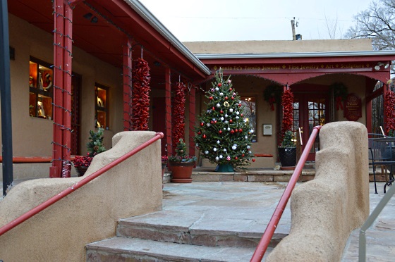
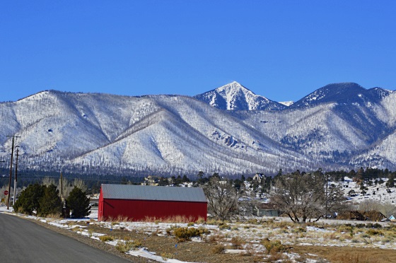
After our stay in Ouray we drove back to Ridgeway which is not in the mountains. but by the mountains. Then turned towards Telluride. Our B&B hosts told us to park by the edge of Telluride on the right. There is a free parking lot. Then you just walk into downtown, which seemed a little bigger that the towns we saw before. Restaurants, shops, as usual in a tourist and skiing town. But the biggest attraction is its free gondola! Nowhere else there is a free gondola as far as I have heard. Not one-ᅡᅠ even two of them.ᅡᅠ The first lift is very steep and a little scary. Then the gondola stops on the top of the mountain ridge: 
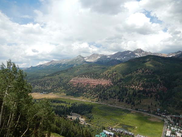
From there the mountain bikers are riding down. There is a restaurant there with good views. Then the gondola goes down to the other side of the ridge, to the Mountain Village, which is not a village in its classical sense, but a concoction of rich condos. On the way you see the ski tracks for the winter and the surrounding mountains: 
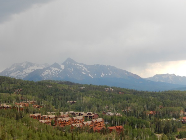
And once you get out of that gondola and you are not the one who stays in one of the condosᅡᅠ you do not have much to do there. So you go to another gondola, which takes people just over the tops of the condos to a food store-ᅡᅠ what a way to go shopping! 🙂 You see the lavish life style in full swing under you and that is the attraction. I guess. Also – you can hike down from the food store-ᅡᅠ the hike is not steep. So here you go – taking gondolas was our fun in Telluride. Once there -we drove to the very deep end of it and saw a peculiar thing-ᅡᅠ a big house built very close to a waterfall on a steep cliff, with no roads leading to it-ᅡᅠ I wonder?!
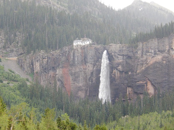
I guess you have to stay in a town to fall in love with it.ᅡᅠ But it would be hard to love so many towns :-).ᅡᅠ So we drove out of Telluride and towards Cortez. Rt. 145 on the map is shown as a scenic road and it was. Very very scenic. But there we heavy clouds and we were tired, so we didn’t stop for every good view. However, we stopped in Rico – it has an authentic house turned into a hostel or a hotel – it was pleasant to walk in its empty corridors and hear the ghosts. It has a wild hot spring close by:
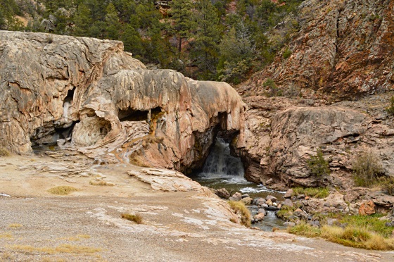
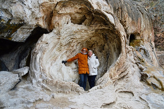
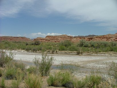
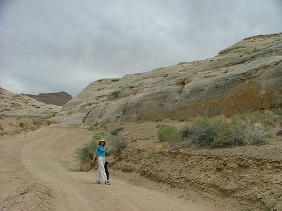
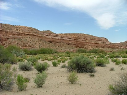
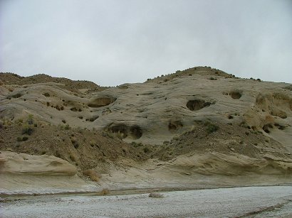
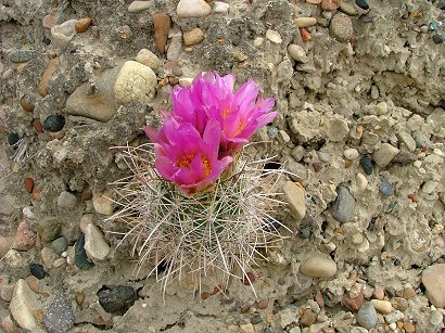
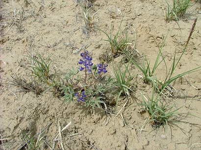
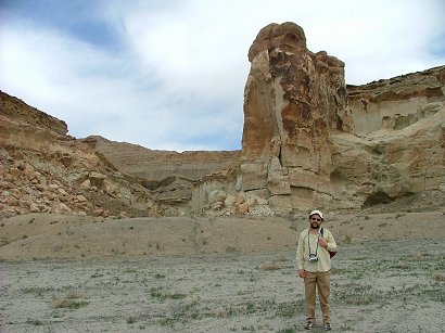
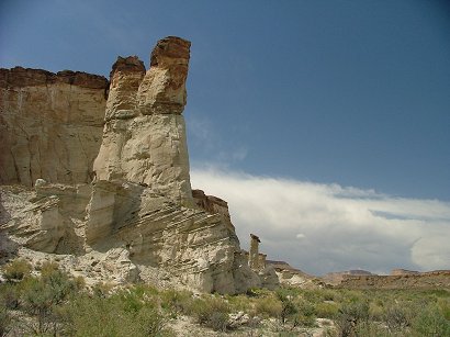
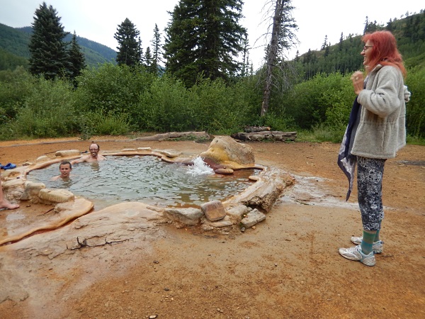
But once we came – there was a company of 5 soaking in it. so the math didn’t work for us…So we drove to Cortez where hotels on its North side are much more expensive than the ones on the South side :-). We picked American Holiday Mesa Verde Inn – it was in front of the restaurant Mi Mexico – that we remembered from long ago – and it was a good choice! The hotel was very quiet and the restaurant served very good Mexican food! We wanted to go to Mesa Verde – but after some analysis figured out that we had no time for it-ᅡᅠ it takes at least a day or two to see it well, the drives are long there and you have to take excursions if you want to see at least one of the ancient houses or towns, whatever they were. So we chose to visit Howenweep NM instead. Therefore the next morning we drove on a small road through the Canyons of the Ancientsᅡᅠ NM and stopped and walked in one stop. Didn’t walk much -ᅡᅠ had no time. But walking on this sandstone was pleasant and it would be a good idea to stay somewhere close by there and hike and hike:
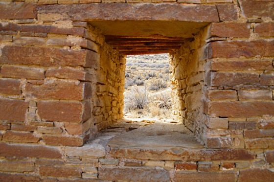
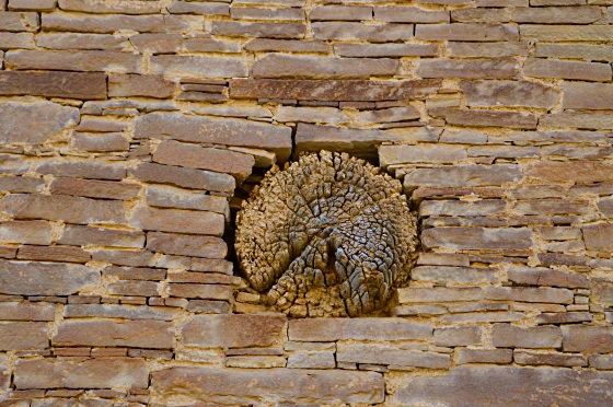
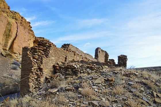
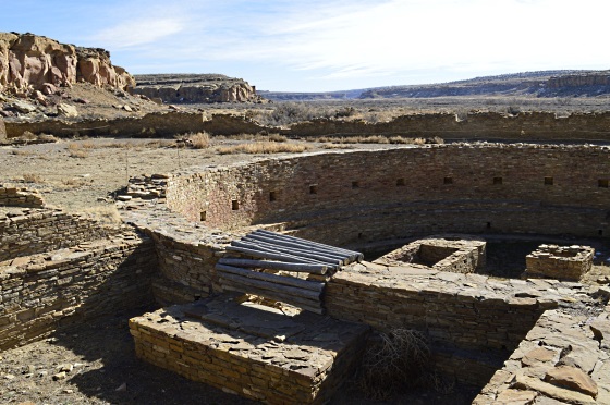
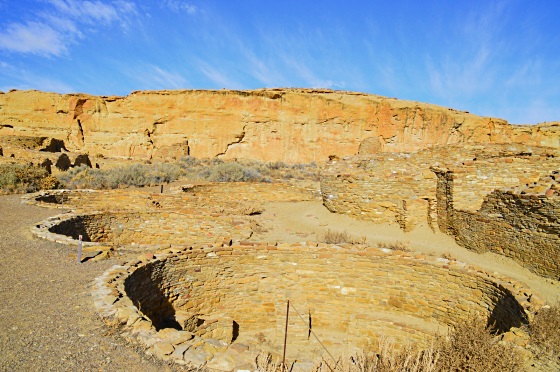
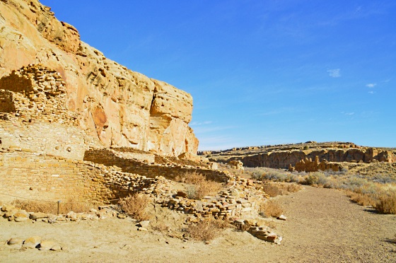
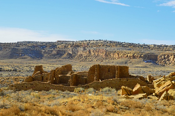
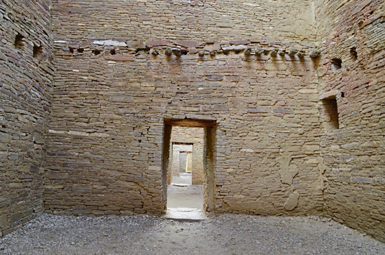
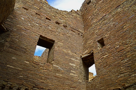
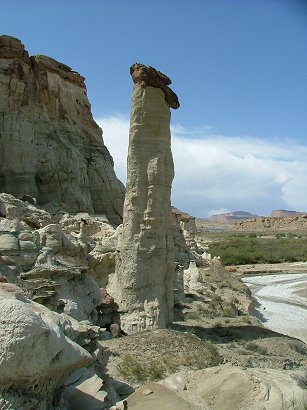
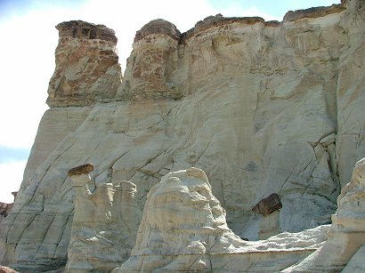
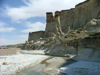
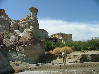
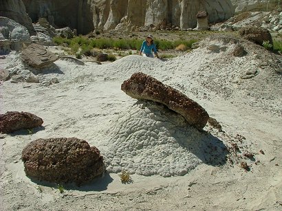
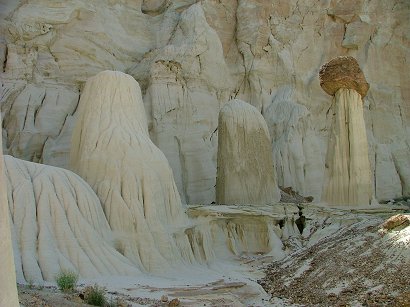
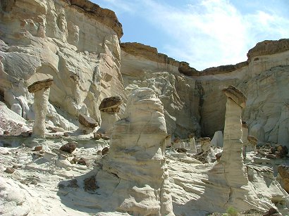
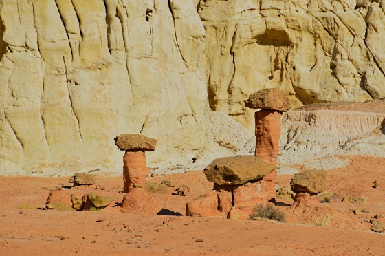
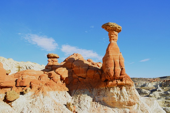
Because all this area is full of signs of Ancient Indians living there! Here is the Howenweep NM – it is a canyon where life flourished ages ago. They have a few structures still standing, as those Twin Towers, and a few mysteries still lingering:
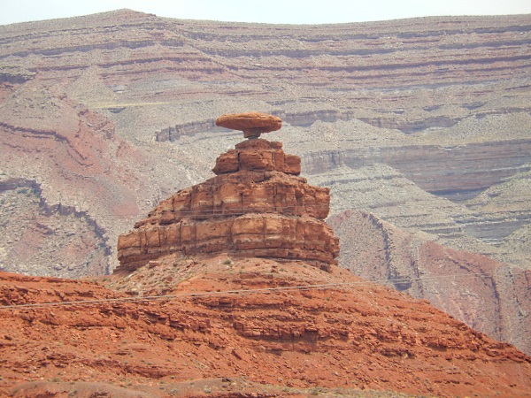
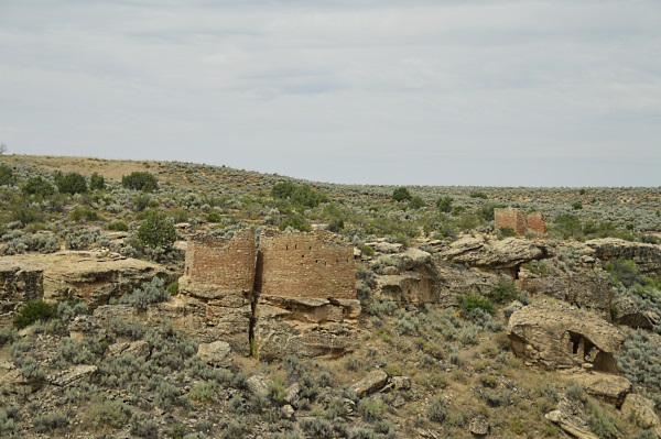
Thenᅡᅠ the drive was long…We listened to a book about Albert Einstein, a really good one, but still. We saw Mexican Hat on the way and the the Monument Valley with the place on the highway where everyone stops and takes pictures. Why – because Forest Gump stopped his long run through the US exactly there! 
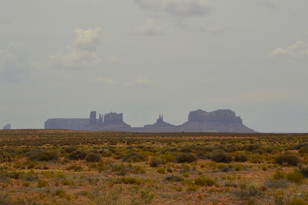
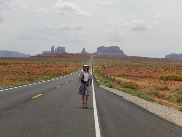
THen we noticed that the glorious Mittens of the Monument Valley are eroding, they have lost their ‘thumbs’ and do not look like mittens any more…
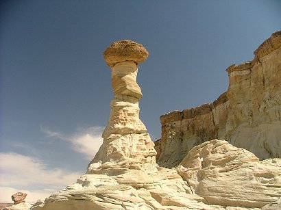
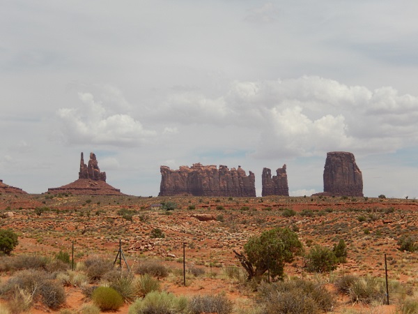
But the rock that looks like a mountain from a fairy tale -ᅡᅠ still looks inspiring:
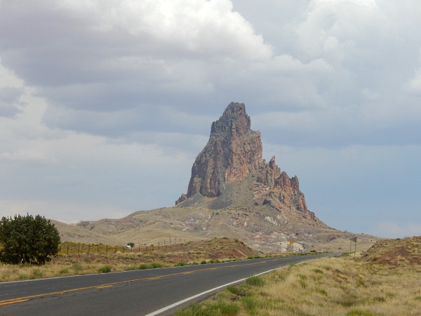
Then a little stop by this monstrosity of the Hydro power station of Lake Powel:
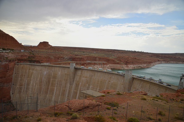
And we returned home to our super hot summer, to our permanent irrigation and tending our peaches and tomatoes!


A Trip to New Mexico & Arizona – Part 2

Because it was December – what can you expect of the weather? Thank you God for a a still warm and sunny day in Chaco. but in two days it was snowing like hell and they closed Rt. 25 from ABQ to Santa Fe. We lost the chance to see the downtown of Santa Fe…Though we tried – and after driving north some30 mi – we were blocked from driving further. So we returned to downtown Albuquerque and walked in the rain -it wasn’t so easy to find the old downtown there either, but once we found it – it was nice, had some galleries and the church, as usual in Mexico.

The next day was sunny again and we drove to see Acoma -a live Indian Pueblo on a cliff – but it was Friday and it was closed for visitors. How it works – you have to go to the visitor’s center (which is nice and modern. built by feds):

_DSC0461


and you pay for an excursion with a guide to be taken to the pueblo.You have to pay additionally if you want to take pictures. So we lost that opportunity, next time. From there we headed to Truth or Consequences- a strange long name for a small town which some 50 years ago had a name of Hot Springs/But then they changed the name in order to be advertised on that popular show, and never changed their name back. So now they are usually abbreviated to TOC. Boy. we liked it! The hot pools at River Bend hotel and spa were fantastic! On the bank of Rio Grade, literally:

_DSC0471

_DSC0493

The sun was setting, the colors were warming and the shades were getting wider and longer, even a Blue Heron came to look for food in front of our eyes – and we were dipped in the warmth of mineral waters – what else can a person want?_DSC0520

Here is a “jazzy” artist’s gallery and home, and the next picture is the decors in their museum fence, which is worth visiting!_DSC0535

_DSC0536

After enjoying the pleasures of TOC for an eve and a morning. where they were carrying coffee to all who were meditating ion the pools, we figured out that the windy weather is not good for visiting White Sand dunes NP, and changed our plans – drove on mountain Rt. 152 to Hillsboro and Kingston – two semi ghost towns that had some Christmas celebration that day. This old but very well refreshed truck was for sale at $6000:

_DSC0554

_DSC0559

_DSC0562

_DSC0570

_DSC0578

We reached Silver City late afternoon, had some walks in its countless galleries (somehow many mining towns nowadays are turned into artsy towns with lots of happy retirees). And the next morning we proceeded towards Arizona through back roads.it took us pretty long.but we didn’t hit any big cities. just enjoyed the mountains, the views and at last, saw the saguaras:_DSC0593

_DSC0609

_DSC0616

_DSC0624

_DSC0629
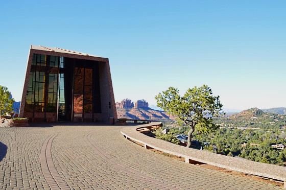
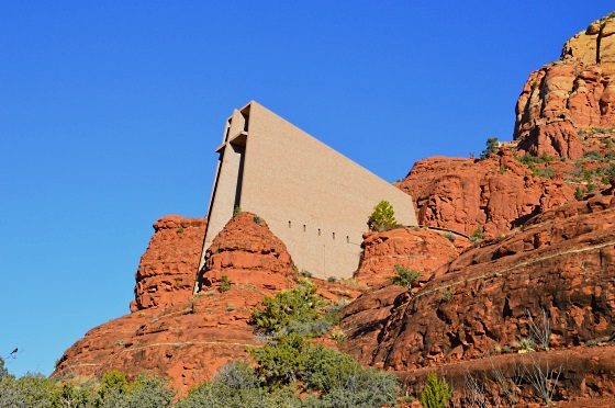
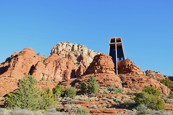
After sunset we reached a town close the the highway and close to Sedona, that was enough for the day. Next morning in Sedona while looking for a map of their famous energy vortexes at an information center we were toldweshould have stayed in Sedona for free…for they are still catching whom to sell time shares…Are there still people who have too much money to throw away? But at least we found out where the closest male energy vortex is and stopped to see or feel it 🙂 and to take pictures of the surroundings in Sedona:

_DSC0634

The most impressive to me is their Church in the Cliffs: _DSC0641

_DSC0654

_DSC0655

Then we rushed home, drove through the snows and more beautiful views:_DSC0664

_DSC0672

_DSC0690

Until we reached the Eastern end of Zion and the pictures we took there are posted in the previous post!

Till next time!


A Trip to New Mexico & Arizona – Part 1

Years ago we read about Chaco culture, saw a movie about Chaco canyon and the historical park there. It was in the back of our minds to drive and see it, all shrouded in mysteries. At last we found a chance to fulfill the dream. My neighbor Sharon Hatfield is literally mesmerized by that canyon, she has read everything and done the trails there several times each.So we felt that for the beginners we will spend at least a day there. On the other hand – December is not the best month to go on trips – the days are short, one can get into winter storms, not recommendable… We left on December 2nd – it was still warm and nice here. much colder towards New Mexico. First stop – Toadstools, past Page:

_DSC0291

_DSC0297
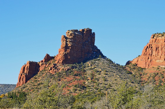
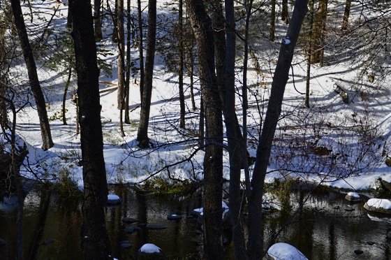
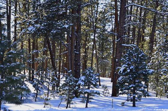
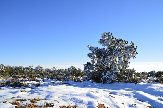
Then we started seeing snow…the first one this year:

_DSC0311

We were driving towards Farmington, NM, and the sun was setting while we approached Monument valley – so we turned to the side and drove for a while till we could “catch” this beautiful rock:

_DSC0315

and another one:_DSC0318

And then we already had to drive in the dark till a hotel in Farmington. The town has a nice little downtown with some nice restaurants, even a Thai one. Is is a good place to stop in order to investigate ancient Pueblo Indian sites, of which two are by the town – the Salmon Ruins and the Actech Ruins. This time we had no chance to see them, we headed to Chaco canyon which is maybe 2 hours drive, of which 16 miles were on a bad desert road. But the weather was good and the views were very wide and undisturbed. The first object that came into sight was the Fajada Butte – it is in the middle of the canyon and known for its astronomical markers. There are three rocks leaning against the wall on the top of it and they are aligned in such a way that a thin “dagger” of sunlight shines through the slabs and onto the cliff face at noon each day. There, people carved two spirals into the rock. On solstices and equinoxes the sun dagger falls onto the center or edge of those spirals -based on that they knew when to start their religious rituals and celebrations.

_DSC0323Then there are several “Big houses” scattered by canyon walls – really big houses, with several hundred rooms each. They were built during the period of A.D.850 and 1250. then they were abandoned, thus creating a big mystery. the canyon is pretty dry, how could such a civilization sustain itself? How could they build such big houses without having metal or wheels, using only stone tools?And no trees there – they carried thousands of trunks by foot from forest as far as 60 miles…What had to be their religion or other unifying force to make them work like this for next to nothing. There are evidences that the builders didn’t even live there…Only very few people inhabited the big houses, otherwise they were used for rituals and maybe some trade? Only questions, very few answers still. Scientists analyze how their building styles changed, how they were aligned to the four cardinal directions and also zenith and nadir, how they could built without any design and came up to similar patterns all over San Juan River basin, how they tried to align the Big houses to the so called sacred geography, the travels of the sun and moon through the sky at different times of the year, and maybe therefore enjoy their lives harmonized with nature better than any people living now.

_DSC0340

_DSC0341

The idea of their sacred geology was to find the center place where all 6sacred directions converge and where symmetrically opposing forces are balanced. There they built a pueblo,and Chaco pueblos are their way the center for all the surrounding pueblos:

_DSC0342 _DSC0346

The round structures are called kivas and it is there where their rituals were performed:

_DSC0350

_DSC0352

_DSC0356

There are around 11-12 ruins of Big houses and many small ones, it is hard to see them in several hours but to get an idea how it looked like and to hike a couple of trails – it is possible. The biggest house is Pueblo Bonito – with hundreds of rooms, some parts of it 5 stories high. WE saw it only from the bottom, didn’t climb the very narrow and steep trail to the canyon edge to see from the top. Not this time. But it was impressive to walk in it:

_DSC0374

Why the windows arranged so strangely in the corners? To get the sun rays at certain times of the year and of the day:_DSC0376

Chacoans also had their sacred time. In our so called Western world ordinary linear time outweighs the sacred time, whereas in traditional cultures the opposite is often true. As one Chaco scientist J.McKim Malville writes: “Sacred days commemorate great events of the past. Because the earth keeps revolving around the sun, these days , such as winter solstice, keep returning year after year.At these times the sacred seems to enter the ordinary world”._DSC0379

_DSC0380

_DSC0383

That evening we reached Albuquerque. New Mexico has such open spaces and wide horizons that to me it is a state of the most beautiful sunsets. Well, maybe not “the most”,maybe “one of the”. Our next drive was through a very spectacular canyon through Jemez Indian reservation on Rt.4,passing Los Alamos and reaching Santa Fe. It is a long drive.

_DSC0400

Some hot mineral springs come out by the river and form hose rock formations:

_DSC0407

Our friend Dalia Narbutas from ABQ participated in this trip:_DSC0413

_DSC0424

We stopped and ate on the Musem Hill in Santa Fe and then had a nice gallery walk in its Canyon road._DSC0433

_DSC0442

_DSC0447

In Dalia’s neighborhood some enthusiast has a knack for decorating his house:

_DSC0453

A Mining Town Jerome in Arizona

I haven’t written for a while, it was a busy summer. We had no time to travel, so there was a pause in my posting. But we still did one trip in the end of hot July when the monsoon clouds in teams were crowding the skies:

And then they would concentrate into one bundle and rain:

So we headed south to Arizona and down past Flagstaff to Prescott. But on the way there was Montesuma’s Castle. It is just a name for an ancient Indian dwelling built in the crevices of the rocks. It is definitely worth visiting, except the timing was not good – way too hot. The sweat was running and the short trip from parking to the castle seemed like a hard walk. But the view impressed. It is unbelievable how those people were not afraid to live so high up, to raise their kids without losing them to the bottom and constantly climb up and down for the water supplies from the river:

Next day after staying for my Bowen class in Prescott we drove back towards Flagstaff through Jerome. It is located on a rather steep slope of a mountain, but luckily not as steep as Montasuma’s Castle. Maybe that is the reason people still live in Jerome, though some of its buildings are abandoned and it gives some charm to the town. The main street is winding down the slope and here we see a house for sale – it is listed as a previously operated Brothel with two big windows for the girls to show their beauty. I don’t remember the price of it, but it was reasonable:

And the street winds down:

Looking down from Jerome into the Valley we could see the Jerome Museum set in some rich person’s mansion who established his riches while running the copper mining business in the mountain. It is a pity we were too late to visit it.

A church turned into a hotel?

The remnants of a hay-day bank in the center of the town:

The same bank from the side street:

And one more image of it – I guess I liked it:

In one of very short side streets we noticed that we could not only look around but also – take a movie ourselves:

And that was it, the darkness came as it always does very quickly in these southern countries…

Wahweap Hoodoos by Page, AZ

We did this trail on May 6th, 2008. The beginning of May was very slow with guests at our B&B, so we used one of the days off. It took the whole day. To drive to Big Water from us, Zion NP, is more than 3 h. Then we parked the car at the end of a dirt road which lead deeper from Big Water and ended by a very wide and almost dry river. The hard duty cars, I guess, could drive further. But we proceeded to a 9 mile walk. At first it was confusing – the mountain lines were wide apart and two almost dry rivers were meeting somewhere here. We took the road which lead to one of the streams and towards the mountains first, but after meeting very disappointed Austrians, who were confused about the map BLM gave them and after having wondered for a couple of hours in vain -we decided to cross the desert towards the previously seen wide river bed and follow it.

dscf6442.jpg

dscf6447.jpg

Though it looked attractive and led mysteriously to some hills and rocks, it was the wrong road, one has to turn left from it, cut the desert and follow the wide river bed at wetter places covered with white salts.

dscf6445.jpg

We had our lunch sitting in one of those rock holes, listening to the silence and looking into the vastness of nature:

dscf6451.jpg

Here are the very few delicate flowers sticking from the desert floor:

dscf6453.jpg

dscf6458.jpg

dscf6454.jpg

even the lupins:

dscf6462.jpg

Those are the views we saw walking further and further – it seemed endless…

dscf6460.jpg

But the hoodoos we were striving to see were much further…over there in the distance to the left:

dscf6463.jpg

dscf6471.jpg

At last, here they were. We saw some immediately by the river bank and some behind a corner to the left. A big group of mushroom like rock formations that happen to be sculpted by nature forces in certain rocks:

dscf6474.jpg

dscf6477.jpg

dscf6479.jpg

Due to occasional rains the area gets some of them are gone forever…only their dark brown heads are still sticking from a melted stem:

dscf6483.jpg

Some are still standing erect:

dscf6485.jpg

but already quite a difference in comparison with pictures we saw in galleries which enticed us to come and check for ourselves. I mean they look very different, very much melted:

dscf6500.jpg

dscf6490.jpg

dscf6491.jpg

dscf6495.jpg

dscf6502.jpg

That was it. We headed back all the same way in this wide space of the river which apparently has had water once upon a time… The trip took us totally 5 hours.

dscf6470.jpg