Yosemite National Park

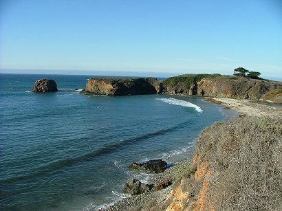
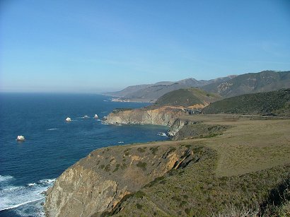
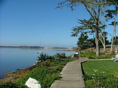
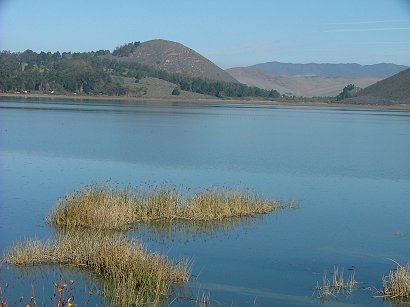
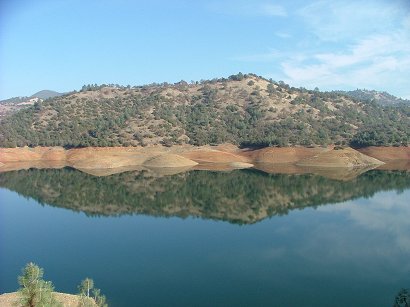
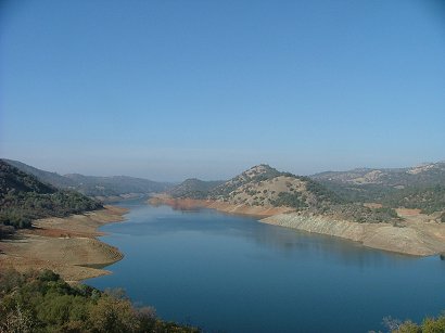
We went to Yosemite NP during our December California trip – not the best time of the year…it was very cold over there and parts of the road were icy. I am sure it is so much better to see Yosemite in summer when the rest of the US is in sweltering heat. But we run a B&B and we have irrigation to do, so summers are not free for travels. And not only that – when I saw how small Yosemite canyon is, how crowded the traffic may get there in season because it is advertised as almost one of the wonders of the world…no, I don’t want to go there in summer. Getting there is such a long drive…At least two hours after you leave civilization on a winding road where you have to be really careful – parts of it are icy and the big trees are so close on both sides…We drove into the park on Rt. 120. On the way, more than 2 hours before the Yosemite Village – the views were much better, with a Tulloch lake in between rolling hills:

tulloch-lake1.jpg

tulloch-lake2.jpg

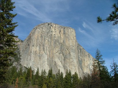
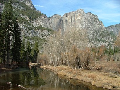
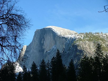
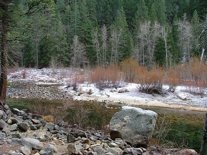
So much of beautiful views…Then for two hours – only big trees and dull mountain slopes. And at last – we saw those so photographed peaks, but the waterfalls were “shut off “- because of shortage of water…We did two rounds in the canyon with the expectation that we are missing something, that such an advertised park should have so much more to offer, but no. We left very disappointed, sorry for ourselves to again have to drive such a long trip from it…Besides the big trees and those 2-3 well known peaks that the park has, it has nothing extraordinary, more than our Zion NP has, and it has twice of the visitors than Zion has. Zion is a longer canyon, and it has so many more beautiful picture perfect views from any part of its scenic drive. Driving to Zion is so much shorter and much more spectacular. Oh well, the power of advertisement! At least – driving back to the central valley was much better because we took Rt.140 which took us by Merced river and it was much more pleasant.

el-capitan.jpg

yosemite.jpg

half-dome.jpg

merced-river.jpg

My advice: unless you have several days to spend and a reserved room or tent in Yosemite, it is not worth going there for a short one day trip. Consider Zion NP :-). Unless it is mid summer and it is really hot.

Our Central California Coast Itinerary

I will write this for those who need an idea of how long it takes to drive from L.A. to San Francisco mostly on the coastal Rt. 1 and see something interesting on the way. We started in L.A. day 1st. and visited Simi Valley during lunch time, then reached Santa Barbara, spent some time there and came to Solvang around 4 pm CA time. I remember that because at 5pm they close all the little stores in Solvang, but they keep the wine tasting places open till 6pm, so we had a chance to taste some 9 sorts of wine. The next morning we spent a couple of hours in Morro Bay, then stopped in Cambria and reached Hearst Castle around 2 pm. Each excursion there takes about 2 h. So after watching the big screen movie they show in the visitor’s center we rushed out to drive as much as we could in the daylight. The sun was setting down pretty fast, remember – it was mid December…So by the time we reached Big Sur – it was totally dark. Ant it is not advisable to come to Big Sur in the dark – hard to find a place to stay. On day 3 we spent some morning time hiking in the State Park by Big Sur, then had lunch on one of the Piers in Monterey, had no time for the Aquarium…Drove to Santa Cruz and walked a little in its Downtown, the Pier and by the time we finally found the Mystery Spot in the redwood forest by SAnta Cruz, it was getting dark. We reached the Lodge on the North side of SC in complete darkness. Good that the lodge had a sauna and a jacuzzi tub, it helped to relax after this hectic trip. On day 4 we enjoyed some morning sunny time on the rocks by the ocean on the northern part of SC and then drove towards San Francisco with short stops. We reached Golden Gate Park around lunch time and had some of our food in the beautiful settings of the park on a table by the lake. After looking around the park we reached the Chinatown area and found a parking there around 4:30 pm. So we hade some daylight still. The next morning it took us several hours to investigate the Piers and Ghirardelli Square and then the Golden Gate bridge area. After driving north and turning East towards the wine country we reached Napa Valley in twilight. On day 5 we drove a lot, in the fog at first and then in the sun until we reached Yosemite NP, spent there a couple of hours and reached Bakersfield for supper and night.

San Francisco, day 2

The next morning we drove through the Crookedest street, through the Russian Hill down to Fisherman’s Wharf and stopped at Ghirardelli Square. it was Sunday ant there were plenty of spaces available to park the car for it was not a late morning. Later those spaces disappeared. There were historic ships on that pier, the views were beautiful, no rain, lots of Chinese jewelers selling their creations for good prices by the cable car stop, what else can one wish for. Yes, and SF has skyscrapers, I guess built in special way so that they’d not be knocked by the first strong earthquake…

dscf5675.jpg

You can see Alcatraz in the distance. It is on an island, maybe that is why no one has escaped this prison, ever.

dscf5673.jpg

Golden Gate bridge from different locations:

dscf5679.jpg

dscf5681.jpg

After we passed Golden Gate bridge, which was quite an impressive drive, we came to Sausalito on the other side and had lunch in a nice restaurant sitting outside in front of thousands of “parked” yachts:

dscf5690.jpg

Then we drove winding roads towards the ocean again and here is what we saw:

dscf5695.jpg

dscf5699.jpg

And yes, I like plants. No matter how little time I have at the moment – I can’t go indifferently by them…

cabbage-flower.jpg

San Francisco, day 1

sf-art.jpg

We reached San Francisco around lunch time and found ourselves directly in Golden Gate Park, the largest man made park in the world! It is 3 mi long and .5 mi wide and has plenty of parking places as well as big trees, ponds, lawns, flowers and also the de Young Museum, Japanese Tea Garden, the Botanical Gardens and The Conservatory of Flowers. They are all worth visiting. The Nature museum is being restored and is coming soon. It can be seen in the picture in front of de Young museum behind the big square. Here is the very modern de Young museum with its observation hall and the views from it:

museum-with-observation-hall.jpg

sf-version-of-sphynx.jpg

sfview-from-tower.jpg

sfwhite-view-from-tower.jpg

On the right side looking from de Young there is the Japanese Tea Garden. It is small, old, very well taken care of and has several Japanese pagodas inside.They charge entrance fee. And while there you can also taste teas and participate in a tea ceremony.

sf-jap-tea-garden.jpg

The Botanical Gardens at Srybing Arboretum are like the extension of the park , except that they have little names under each tree. The trees are tall, beautiful, some are peculiar, never seen before. There are a lot of squirrels under one of them, they are making a show there while running around guests and asking for a treat. But only under one tree…There were not too many flowers in December. Actually, here is the only area we found densely blooming and this only purple flower smiling at us from high up in the green growth.

sf-flowers-in-the-park.jpg

sf-flower.jpg

sf-tree.jpg

Then we drove to Downtown SF and after several rounds around Chinatown, for joy for joy! we found a parking spot on Vallejo st. by Grand ave. Here on the corner we found a cozy Thai restaurant to be really tasty! And we went around in Chinatown but it was getting dark. Here is the last view that day – taken from our parking space:

sf-downtown.jpg

Santa Cruz

We didn’t too much in Santa Cruz so I thought maybe I shouldn’t even mention it. But then I felt it was the best seashore I saw during the trip. It was warm (while it was almost freezing during the night just a few blocks from the ocean) and it was peaceful, no wind, just the sending its rays to the sparkling waves which were beating their rhythm under me and spraying me with the salty water. The perfect place to do Tai-ji! I guess there and not so many places or moments in life that you can enjoy and feel the forces of nature so close to you and at the same time – so calming and peaceful!

tai-ji-in-santa-cruz.jpg

santa-cruz-shore.jpg

When you turn you head from the sea – the houses that line the shore are also well worth to stand where they stand. Some of them have amazingly big aloe veras in front colored in orange by cool winter.

a-house-in-sc.jpg

All those views are in the North side of Santa Cruz. it also has a State Park there:

state-park-in-santa-cruz.jpg

But before that the previous evening we drove to the Mystery Spot somewhere by Santa Cruz in the redwood forests. I write somewhere because every santacruzan I asked about its whereabouts mentioned the name of the street or road but have never been there before. It was tricky to find it because there are two roads by the same name Branciforte, going almost parallel, the only difference is that one is road and the other one is drive… And of course – the first time we took the wrong one which lead us to a beautiful golf course. After the inquiry there we found the Spot!

mystery-spot.jpg

There is no use of describing of what is already extensively described about the Spot in the internet. One of good descriptions: http://www.roadsideamerica.com/attract/CACRUspot.html

Just one little fact – once I got from the car in the parking there, which was still not considered the Spot, just “by” the Spot, I already felt rather weird, my lower back in pain, I could hardly climb the hill to the shack…In the shack I was very dizzy and had to hold onto the rails not to extend my length through the whole floor. After we left in some 2 hours the back pain disappeared. No comment…

From Big Sur to Monterey

The town of Big Sur is very dark at night. It is not a regular town. Rt. 1 turns from the ocean behind a mountain to return to the ocean again. There are lots of redwoods in that canyon through which Rt.1 passes. It is narrow, protected from ocean winds, so houses and hotels-resorts are built by that road and extend several miles. At night it is very dark and not very convenient to look for lodging. Better get there while it is still light or make a reservation. Not to waste time and energy in stopping and asking for vacancies or prices. Because it is so popular among celebrities, as they told us, some hotels charge $800 per night… And as nowhere else we came across in California, most of the hotels don’t have high speed internet. Just north of the town there is a cute Andrew Molera State park, which charges $6 per car. But it is worth visiting – the path leads through Big Sur river and then by it towards the rocky shores of the Pacific. And yes, it is not so easy to cross the river – although there are some bigger stones thrown on the path, but your feet still get wet. Solution: you have to either go barefoot (cold in winter) or have big waterproof boots. Well, we got wet in our sneakers, but that’s what happens when you travel. There is a beach all covered with very long seaweeds which look like giant snakes. One and has a big ball of the same seaweed body. The other has a grown stone into the weed. So it is not easy to lift them. The ocean is making rather loud sounds of big pebbles rolled by the waves.

dscf5599.jpg

dscf5602.jpg

After that driving was very very beautiful. Sea on one side, cows (lucky them) and hills on the other and no civilization at all. Except for one lighthouse. Here is the view from Hurricane Point towards the Bixby Creek bridge:

dscf5607.jpg

Carmel showed up pretty unexpectedly. At first the modern part of town, meaning malls and stores, then we noticed a Carmelite monastery, nicely located among the greenery. So we stopped and smelled the church – there was not a soul there, but the doors were unlocked like in a good catholic country, so that all in need could stop and pray surrounded by pleasant incense.

dscf5610.jpg

And then once of a sudden – we found ourselves in Monterey! With the sea lions making a big noise by the warf- I bet they had their lunch already and were trying to comfort themselves for a good afternoon nap but still they had to fight for a better place on surfaces sticking from the water:

dscf5612.jpg

Views from one of Monterey’s warfs. A pretty good seafood restaurant on the Warf with the views towards lots of yachts. We enjoyed not only them but also watching the cook prepare and cook each meal.

dscf5613.jpg

dscf5614.jpg

dscf5611.jpg


Hearst Castle, San Simeon CA

It is something really peculiar. In the middle of nowhere, where the rolling hills by the sea become totally desolate, empty of almost any growth, just some dry grass, and some little groves of trees, no civilization around, far away on one of the hills one can spot some towers – like in a fairy tale my grandma used to tell. Then there are signs to the visitor’s center where you park your car and buy tickets to Hearst Castle. There is like a bus station there and they take each excursion up the hill. One excursion shows only a portion of the castle which is so big and has so many rooms, so many buildings, decorations and gardens around. All that is described in their web site. Based on Wikipedia the rich media man Mr. Hearst started building the castle in 1919 and stopped building in 1947. it is still unfinished. But you won’t notice that. Is it beautiful – well, here I am posting some pics for you to decide. It has too much of everything to have a distinct opinion. It has so many antiques from Europe that it is hard to comprehend it…I guess most of the rooms look like most of the castles in Europe. The castle has no main entrance. So here is what we saw once we entered its premises through the side stairs.

hearst-castle-1.jpg

hearst-castle-2.jpg

hearst-castle-3.jpg

hearst-castle-5.jpg

hearst-castle-6.jpg

Mr. Hearst liked to host big parties and lots of celebrity guests. Here are their guest rooms in guest houses.

hearst-castle-7.jpg

hearst-castle-8.jpg

Casa Grande itself and its elaborate doors – did Mr. Hearst want to compete with European Cathedrals or what?

hearst-castle-9.jpg

hearst-castle-10.jpg

hearst-castle-11.jpg

The inside swimming pool…

hearst-castle-pool.jpg

The views of Big Sur driving north from the castle.

big-sur.jpg


California Central Coast 1

We took Rt 101 from Solvang and drove all the way till we turned to Rt. 1 towards Morro Bay. I am sure we missed lots of good views and beaches, but… as always – we were in a hurry. Here is what we saw in Baywood Park-Los Osos and Morro Bay:

morro-bay-3.jpg

This is the view by a very cozy hotel we accidentally found by the Bay, called Back Bay Inn. Boardwalks made it comfortable to watch ducks, seagulls and and an egret. Sandy dunes were seen in the horizon.

morro-bay.jpg

Rollong hills led us towards the next destination: Cayucos.

morrobay2.jpg

cayucos-school.jpg

cayucos1.jpg

It was nice to find Duckie’s Chowder house at the bridge entrance to have a lunch. The succulents by the door were amazing – I guess they like such a cool but not hot climate.

food-in-cayucos.jpgcayucos2.jpg

dscf5541.jpg

What amazed us was that the rolling hills through which we drove most of the time were so gray, covered with dry grass, almost no trees, some occasional oaks and no bushes at all. At times the landscape looked very desolate. Only cows were grazing on the expensive California land. Maybe in spring the hills would be greener! Or maybe even blooming?

Solvang

Once you leave Santa Barbara Northwest ant take Rt 154 you drive through beautiful rolling hills, some of them overgrown with grapes, some just with grass and an occasional oak tree. After a pass a beautiful blue lake Cachuma captures your sight on the right. There are no good places to stop the car and take some pictures of it. We found a state park but the views were not as good as from the other end of the lake. Very soon you pass Santa Ynez and get to Solvang, all surrounded with vineyards. The very first hotel we stopped was very good: Swensgards Lodge, sounds Scandinavian! the room was spacious, beautiful and had a view towards one of the windmills and downtown, the windows were blocking well the noise from the street, and the breakfast room downstairs was a cozy one with a fireplace.

Solvang is called a Danish capital in the US. It definitely reminds if not particularly Denmark, but surely Europe. I am not sure how many danish people live there and the people I met on a Kopenhagen airplane said it has nothing to do with Denmark, but anyway – it is cute. In winter it becomes very quiet, all the boutiques and little stores close at 5pm. Even the wine tasting places, of which there are plenty, close at that time. Only some restaurants remain open. Solvang resembles a souvenir town all lit with Christmas lights and with several windmills sticking from its landscape . Some say there are 6 , some say there are 7, or maybe more windmills…

Advice: stay in Swensgards Lodge and do some wine tasting. There is another town higher in the mountains, 30 mi from Solvang, called Los Olivos – they also have wine tastings with hors d’ouvres and various events, so it could make a nice holiday weekend even during off season.

little-mermaid.jpg

solvang2.jpg

solvang3.jpg

solvang1.jpg

Santa Barbara

Just an impression for we have spent too little time there. It is really beautifully located on the slopes of San Rafael mountains towards the sea – so most of the properties can see sunsets into the ocean. They can also see the Channel Islands. There are enough missions to see them everywhere ant it gives some historical taste to the nowadays look of the city. Luxury is felt everywhere. I have a theory why people are rich over there -because jade plants grow so well in their gardens! Chinese say that jade plants bring wealth – as simple as that. It is mid December – ant the flowers are blooming! No advices for S.B. – just some pics.

downtownthe-presidio.jpg

santa-barbara-state-street.jpg

in-la-arcada.jpg

santa-barbara-victoria-street.jpg

santa-barbara-old-mission.jpg

aloe-vera-blooming-by-the-mission.jpg